The subject of gay bars from the past really interests me.
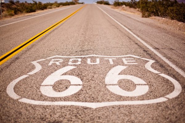
Route 66, a National Treasure of the National Trust, winds its way some 2,400 miles from Chicago to Los Angeles. It weaves past small towns, big cities, National Parks, roadside attractions, and also: gay bars.
As one of the first cross-country highways, Route 66 connected refugees from the Dust Bowl to safety in the 1930s, troops to military bases during World War II, and post-war Americans to California and the western states in the 1950s and onwards. While I traveled Route 66 with the National Trust from Chicago to Springfield, Missouri, I documented places in communities along the iconic highway that historically welcomed gay travelers.
The subject of gay bars from the past really interests me.
Where I live in New York City I lead a walking tour about “gay bars that are gone” and people who attend share histories and sometimes memories from LGBT spaces, dating as far back as the 1870s. These are spaces where gay Americans found joy, love, community, and solidarity in the face of great social and political adversity. To document the “gay bars that are gone” of Route 66, I came with a few important things in my suitcase: two LGBT USA travel guides from the year (coincidentally) 1966 and a rainbow flag.
The travel guides were incredible. Both are rare finds and I had to convince folks from far away to scan archival copies and send to me. One was titled: The Lavender Baedeker ‘66: A Guidebook to Gay, Interesting, Hysterical, and Historic Places in the U.S., and it was published by a company listing LGBT-friendly establishments since 1961. The other guide was a Damron Guide from 1966, which is an LGBT travel company that still exists and has been publishing gay travel guides since 1964. This third edition Damron Guide chronicled more than 900 places across the United States and Canada recommended for gay travelers.
By Michael Ryan – Full Story at SDGLN
 The sign at the intersection of Adams Street and Michigan Avenue in downtown Chicago that reads “Illinois US 66: Historic Route Begins” is small, unremarkable, and arguably an unworthy trumpeting of the road that is ahead. Indeed, not a single office drone pays it any mind on this gloomy fall morning as they rush from the city’s lumbering El trains to their designated steel and glass towers for the day. Nevertheless, Ryan and I stand in front of it with beaming smiles and angle our iPhones just right so that we can snap a selfie that will surely be the envy of all.
This is day one of an eight-day, turn-by-turn journey that will cover all 2,448 iconic miles of Route 66, the most famous highway in the United States. It was designated in 1926 and made famous by westward thrill seekers, Dust Bowl migrants, and the oft-covered song of the same name. During its six-decade span it was realigned several times, decommissioned in 1985 in favor of the Interstate Highway System, and brought back to life more recently by road trip enthusiasts, municipalities looking to bolster tourism, and folks wistful of a vanishing America.
Although the road is book ended by Chicago and Los Angeles and winds through the heart of several cities including St. Louis, Oklahoma City, and Albuquerque, the highway is really a journey through numerous small towns to countless to name, some of which have survived and even thrived, off Route 66 nostalgia, and others which have all but rotted. To cross the country via interstate highway is to merely skim the continent, but to do it via painstakingly slow Route 66 is to discover an America that is undeniably friendly, often kitschy, and ultimately vanishing rapidly.
The sign at the intersection of Adams Street and Michigan Avenue in downtown Chicago that reads “Illinois US 66: Historic Route Begins” is small, unremarkable, and arguably an unworthy trumpeting of the road that is ahead. Indeed, not a single office drone pays it any mind on this gloomy fall morning as they rush from the city’s lumbering El trains to their designated steel and glass towers for the day. Nevertheless, Ryan and I stand in front of it with beaming smiles and angle our iPhones just right so that we can snap a selfie that will surely be the envy of all.
This is day one of an eight-day, turn-by-turn journey that will cover all 2,448 iconic miles of Route 66, the most famous highway in the United States. It was designated in 1926 and made famous by westward thrill seekers, Dust Bowl migrants, and the oft-covered song of the same name. During its six-decade span it was realigned several times, decommissioned in 1985 in favor of the Interstate Highway System, and brought back to life more recently by road trip enthusiasts, municipalities looking to bolster tourism, and folks wistful of a vanishing America.
Although the road is book ended by Chicago and Los Angeles and winds through the heart of several cities including St. Louis, Oklahoma City, and Albuquerque, the highway is really a journey through numerous small towns to countless to name, some of which have survived and even thrived, off Route 66 nostalgia, and others which have all but rotted. To cross the country via interstate highway is to merely skim the continent, but to do it via painstakingly slow Route 66 is to discover an America that is undeniably friendly, often kitschy, and ultimately vanishing rapidly.